Tag Archives: depave

Movement and Moment

Over the course of the past year, I’ve been writing my way through a bunch of different thoughts and ideas and the result has basically become the entirety of this blog. At the same time, I’ve also been gradually trying to connect the dots with one underlying theme: that life is all about circulation and significance, the movement as well as the moment.

Since my words don’t always make a lot of sense, I’m constantly trying to find new ways to explain myself and share what I think is interesting about the world: examples of circulation and significance in our daily lives. Most of these places are either what I consider Highways (circulation) or Hallowed Halls (significance). Today, I get to write about a place that embodies both of these characteristics and the tension that exists between the two.

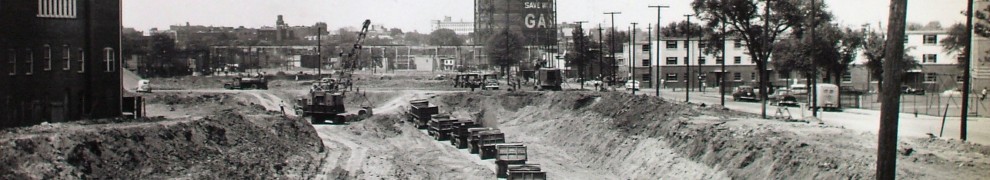
I recently visited the Negro Burial Ground just east of downtown Richmond in Shockoe Valley. My approach to this site was across a VCU parking lot and through a tunnel under Broad St. As you walk through the tunnel, you emerge onto a huge empty field of beautiful grass that was once yet another parking lot in downtown Richmond. In recent years, the asphalt was removed and this area was designated “A Place of Contemplation and Reflection.” I appreciate this area mostly because it’s a complicated place. There aren’t physical buildings that most people would consider “historic,” but what happened on this one piece of ground (the public execution and careless burial of enslaved and free people) is considered enough to make the place significant today. Once a place of fear and violence, it has been restored to the people of Richmond as a place of silence and careful thought.

While I think the site itself is certainly worth visiting, what I really care about is a place located just above the actual burial grounds. From this vantage, you can see that less than 50 yards away from this place of contemplation is Interstate 95 in all of its glory. The cars and tractor trailers fly by on this crazy asphalt slingshot that shoots cars straight through the heart of my city. Like all highways, it’s a totally anonymous no man’s land where you don’t walk, you don’t slow down, and you don’t typically notice the historic burial grounds nearby. When you’re on a highway like this, you don’t care much for where you are because you’re more focussed on where you’re going. That’s essentially the nature of movement.

To get the photo above, I climbed up a little hill to the foot of the Broad St. bridge I had previously walked underneath. For a while, I just sat up on the hill and watched the disinterested movement of the highway next to the contemplative stillness of the old burial ground. I realized that we need both the movement and the moment, but I think sometimes we feel like we have to make a choice: You have to be either ambitious or thoughtful, motivated or lazy. When I experience a place like this, it reminds me that we should be aware of both aspects of life. It also makes me a little more hopeful that my writing is still relevant. What I have learned through writing this blog is still teaching me and making the world a more interesting place.

While I was looking out on the scene, I realized that photos and words are limited media for describing ideas such as movement and moment. So I filmed a brief and simple video (below) that might help to further explain this relationship. It’s much more about the idea than the video itself … and I recommend muting the video sound and listening to Lisbon, OH by Bon Iver while you watch it.

As always, more to come.

P.S.  to Gwarlingo for the movement/moment pairing … it used to be found in their explanation of the meaning of the word Guarlingo which is Welsh for the sound a grandfather clock makes before it strikes on the hour, “the movement before the moment.” Of course, my blog is about the movement and the moment, but I thought it was an interesting side note.

Race in Tyler: A Pie Graph of Color

This is a response to a map of race in Tyler recently produced by Christopher Groskopf (@onyxfish) using the brand spankin’ new 2010 census data. He posted his analysis on the Web site hacktyler.com  titled “2010 Census: Racial diversity in Smith County.” Check it out:

In some ways, what I always knew makes much more sense after looking at this map. I now see that the original El Lugar is in the middle of the most Hispanic section of Tyler. Texas College and Martin Luther King Blvd are in the heart of Black Tyler. South Broadway, the site of most new development and big business in the city, is the backbone of White Tyler.

I think Groskopf’s work compliments thoughts that I and others have had on Tyler and gives me more of a context for the city over all.  Somehow with the language of the internet (which is beyond me)  he has illuminated my city in a way I have never before seen. Granted, some racial realities are not surprising, but the overall experience as a resident looking through this map is remarkable.

When I first looked a the map, my eyes immediately went downtown (pictured right). That black, vacuous space in the middle of my city. It may seem strange to be drawn to an empty space, but it’s because I have a different vision for downtown. In an earlier post, “C-T-D: Thoughts on Downtown,'” I tried to understand the idea of “downtown.” What is it supposed to be in relation to the city? If we understand the idea, then we have a standard of comparison for the reality. Here’s my standard: The first element of downtown is density, the second is urbanity, and the third is a creative economy. Looking at the black space of our downtown reminds me that it is still primarily a place to work and park your car. What would it look like if it was a place to live? Downtown could be the place where all three major pieces of the racial pie meet each other. It could be the center of city life and it could be a place where everyone feels welcome. I know there are dreams for the old King Chevrolet location and other vacant lots downtown … I hope we share these dreams with the rest of the city.

From downtown, my eyes zoom outward. I follow the three pieces of this pie from their smallest points to their largest and I’m amazed at the simplicity of the settlement patterns in our city. Groskopf mentioned the racial segregation in Chicago because in my experience that city is a patchwork of race. Tyler is more of a pie. The white population in Tyler is certainly the most homogenous, but there are some clear demarcations between the Black and Hispanic regions as well.

Here are specific observations:

Physical structures divide urban communities. The clearest example of this for me was the section of Paluxy just south of the Loop (pictured right). This photo is special to me because the black community to the right is in the middle of the huge white piece of the pie. The community also looks clearly sectioned off by Paluxy to the west (left) and other, smaller roads to the N,E, and S. On Google maps, this section doesn’t look any different. I have to admit I haven’t driven around these streets on either side of the color line, but I have this urge to go there and learn more about why the communities have settled in this way.

Invisible lines divide rural communities. I was really unaware of the racial breakdown of rural Tyler before looking at this map. It’s partly because I haven’t spent as much time in rural Smith County and it’s partly because it’s just a bigger amount of space to understand. I think it’s so interesting that north of Tyler the two pie pieces of Black and hispanic communities stops at this invisible line (pictured left) and then White communities continue all the way to the county line. BUT, to the east, there is no imaginary line and the rural Black population is sustained to the edge. I wonder what historical legacy or communal understanding has created these invisible lines? While roads and buildings sustain separation in the city, segregation in the rural areas of Smith County is a little more difficult to comprehend.

There is so much more to learn from this map. I have already spent over an hour looking at the dots on this black field and I’m still amazed at what they have to teach me. I will certainly be referencing this map until the next census and I look forward to thoughts and responses from my fellow Tylerites.

Check out my other Tyler projects at my Tyler, TX page.

New Term: Grand Obsolescence

The term is usually “planned obsolescence,” but the word “planned” doesn’t exactly apply to what our cities look like today. So Grand Obsolescence is the term I guess I’ll to describe the spaces in our cities that have beed deemed worthless and discarded. Just like your iPhone 3 when the new one came out.

A Walmart was built on a highway in Tyler and surrounded by acres of asphalt. Then, Walmart built a supercenter right down the road and left this building to anyone that wants to spend the money to retrofit a warehouse. Thanks Walmart! The parking lot is now (obviously) underperforming asphalt and the building is vacant. The reality is: multi-nationals don’t have any concern for the long-term well-being of a city … they just need to make money. It’s up to the city to look out for itself and to prevent stymie process. The problem is usually a weak planning function and a city council that can only see $$$ with each new development. The result is cities that Kunstler says simply “aren’t worth caring about.” Of course, there is still plenty to care about, but the problem is that you have to drive farther to get to them. And even then … it’s still not usually impressive.

Maybe, we drive so fast we don’t notice these vacant buildings or maybe we just have low expectations. Maybe because our cities grow outward we don’t feel the need to look inward. All I know is, it ain’t pretty and we can do better.

C-T-D: Broadway Center

Here’s the deal: I want downtown to be cool, but I think we need more than one cool place. The historical buildings and “monuments” on the square are worth saving, but they shouldn’t have a monopoly on dense urban development in Tyler. I’m convinced that we can improve downtown and create more high-density developments at the same time. Most importantly, if we connect them to each other, their synergy will have far more positive social and economic impact than they could on their own.

First stop: Broadway Center. Once we have finished building The Complete Loop, we should look to Broadway for the next great artery of development in Tyler. But, instead of the constant retail strip malls and big boxes that you see in South Tyler, this section of Broadway will augment the existing historic neighborhoods with new, high-density developments. Like two weights on the end of a barbell, Downtown and the redeveloped Bergfeld Center will anchor this region. See the difference? Instead of constant retail strip, we will concentrate businesses in two high-density places that will are in close proximity to valuable real estate. It’s better 🙂

Rule #1: Every parking lot in this section has potential for development. It’s a pretty basic rule, but  necessary. Building on parking lots has the capacity to transform ugly/boring/typical spaces into unique and attractive spaces. We also don’t often don’t even realize how incredibly big these parking lots are. We just get used to them so we don’t “see” them any more. I know, people have to park somewhere, but we also deserve to have a beautiful city, right? Let’s find a way to do both.

Rule #2: Reconnect the roads and the complete the grid. More roads means more access and more retail space. In regard to the issue of parking, it also means more on-street parking. If we connect Troup Highway (left) through what is now a parking lot and Stein Mart, it would meen a straight shot to Old Bullard and plenty of places to spend money. Additionally, the connectivity would invite residents of the nearby neighborhoods to visit the new shops, parks and restaurants on their morning walk. According to a recent traffic study, 30,000 cars per day drive by this spot on Broadway — Let’s give them more reason to stop. Also, in order to extend the grid, it would be great to build two new roads through this development in front of (to the right) and behind (left) what is now Stein Mart. This will complete the grid and create city blocks for more dense, protected urban development. Think less people would come? Think again. More people are likely to shop and spend their time in compact, beautiful spaces. These developments are essentially the free-market “one-stop-shop” developments that incorporate a multitude of uses into previously unloved space.

Rule #3: Build to the street on street level. This is important: Don’t pop it up with a “sporty” flight of stairs, don’t put parking in front, and do keep the street trees as a buffer. If there must be parking, put it on the inside of the development. The point is to make the development itself the advertisement for the development. Currently, with a football field of asphalt infront of the strip mall, you have to put a sign out front informing people exactly what it is. With the building built to the road, they will know what it is and they will appreciate the good urbanism.

Rule #4: Finally, of course, make it walkable and bikeable. According to the recent Walk Score report, the most walkable cities in America are, as always, also the coolest cities in America. Tyler was not on the list. Many times when I walk in Tyler I have this feeling like I don’t belong. Today was no different … as I was walking down Old Bullard toward this development the sidewalk ended. There aren’t crosswalks across Old Jacksonville or Broadway and there isn’t a sidewalk along Ninth St. That’s just not acceptable … and more importantly not welcoming. With a little public investment, this could be a completely accessible and welcoming area for everyone.

So that’s the newest node! I’m gradually “Connecting the Dots” in Tyler and hoping one day someone will take my ideas and make lots of money with them.

Check out my other Tyler projects at my Tyler, TX page.

C-T-D: The Complete Loop

Ok, I’m changing my vision for reconnecting Tyler. In my post “Connecting the Dots: Intro,” I called for a loop of streets to be beautified with bike lanes, street trees as well as connected with street cars. My original vision saw the street car loop connecting down Broadway, but today I changed my mind. My imaginary Tyler now has a network of complete streets and a two-way street car loop. The map I have drawn (to the right) is the culmination of about a month of work on my Connecting the Dots project (C-T-D). It’s not a conclusion, but this is this skeleton that will be my foundation for future posts on infill development in Tyler. These developments are the dots themselves: The high-density nodes that should be developed throughout the older parts of Tyler. “The Loop” is the public investment that is necessary to make the entire concept a reality.

It begins with a paradigm shift from the current philosophy on street construction in Tyler. Currently, a street in Tyler (left) is where cars drive. While it seems like a basic statement, this is a relatively new phenomenon credited to 20th century engineers and planners who gave cars complete precedence in matters of urban travel. Before the advent of the automobile, streets were places to walk, gather, transport and protest. Bicyclists were the first promoters of “good streets” in America and streetcars (started in Richmond, VA) were the first modes of suburbanization. When the car became affordable, it trumped all of these previous developments and occluded their progression. In the past century, streets became very dangerous spaces as car-related deaths increased. The gathering spaces in America were lost. In his TED Talk, “The Tragedy of Suburbia“* (*F-Bomb warning) James Howard Kunstler argued,

“The public realm in America has two roles: It is the dwelling place of our civic life and it is the physical manifestation of the common good. And when you degrade the public realm you will automatically degrade the quality of your civic life and the character of all the enactments of your public life and communal life. The public realm comes mostly in the form of the street in America …”

In Tyler, we have certainly experienced this degradation of the quality of our civic life. There are few public gathering spaces. Just so we’re clear, Starbucks is not a public space, it is a private, money-making enterprise. There were once some incredible public spaces in the city, but many were destroyed or neglected … the downtown square is a sad example. Public space today is a scattered system of lovely public parks typically accesible by car. Our streets are often these large asphalt rivers running through the city with cars zooming by at deadly speeds. I drive one of these cars so I understand their utility, but I also understand the benefits of alternative transportation.

The National Complete Streets Coalition (NCSC) states that “Complete Streets are for everyone.” While there is no singular definition of a complete street, NCSC states that a city committed to transportation choices will ensure that “every transportation project will make the street network better and safer for drivers, transit users, pedestrians, and bicyclists – making your town a better place to live.” (NCSC also listed the “elements of an ideal Complete Streets policy” to help local citizens tailor the concept to their locality.) Thus, a complete street will have defined spaces designated to those citizens not driving in cars:

I really can’t expound on this concept any more except to say this: Complete Streets are a message to the citizens of a city. It says, “Come outside, experience our streets and enjoy your city.” Currently, the message is, “Drive here, this speed, when I say go.”

The next stage in revitalizing this section of the city is the addition of a two-way street car loop. This will be an incredible statement of commitment from the public sector and will stimulate private investment at every point along the route. In my map (above) I have designated some locations that are prime for infill development. These typically have a ton of underperforming asphalt and outdated strip centers. The street car loop will be a convenient novelty for tourists as well as a viable commuting opportunity for a number of large employers along the loop. In addition, the street car loop will finally connect the parts of Tyler that are culturally, financially and historically significant: The Rose Garden, downtown, the hospital district, and the Azalea District. I’ll admit, the primary shortcoming of this loop is that it currently ignores the area north of the square. I response, I think that Broadway should be “completed” all the way to Gentry (banner photo of this post) which should also be retrofitted with bike lanes and street trees all the way to the amazing Caldwell Zoo. If you haven’t driven on Gentry lately you might not know how big that street is … it is due for a full retrofit.

So this is my “Complete Loop.” Unlike the car loop (323), it’s beautiful and versatile and it invites everyone to come and enjoy.

Check out my other Tyler projects at my Tyler, TX page.

*I also had a policy thought: Developments and businesses along The Loop would be exempt from zoning laws that require on-site parking. Instead, public parking would be provided at points along The Loop to encourage a “park-and-ride” system.

C-T-D: Downtown, no finer place … for sure

If Jane Jacobs is famous for describing “the sidewalk ballet” outside her window in Greenwich Village, I would like to be the first to say Tyler is in a “sidewalk intermission.” There was a time when our downtown was full of people “dancing” around each other to get to the stores and offices, but I believe we are now experiencing the intermission that happens before a renaissance. Rather than hold on with nostalgia to a proud past, we have to look to the future and imagine how downtown will once again be great in a completely new way.

But when did we begin to neglect our downtown? Petula Clark’s  famous ballad, “Downtown,” offers some insight into the process. “When you’re alone and life is making you lonely,” she sings, “you can always go downtown” … “everything’s waiting for you, downtown.” This song is such a incredible artifact of the 60s zeitgeist and a common reference point for urban historians. The paradigm shift is that in the twentieth century (many say after WWII), the dense urban spaces in America became places to visit rather than places to inhabit and as a result they became neither. The problem is that downtown will not always be “waiting for you” if there are not people living there and sustaining it while you’re gone. Like many cities with oil and money, Tyler followed the trend of outward growth and the commuter lifestyle. Fueled by our cheap, local oil we basically packed our cars and left downtown in the dust.

The result of this growth mentality is that we do not have the money to “care about what we already have.” For every new development in Tyler, the public sector is expected to provide roads, sewage, fire departments, police departments, schools, street lights, signs and other various forms of public services and infrastructure. This cost is significant and it is somewhat needless considering there are vast sums of land in the city where services already exist. As the city continues to cater to new developments, we do so rather than reinvesting the money into older, existing spaces elsewhere in the city. These images of Tyler’s downtown (below) are images of a city waiting to be reborn.

Downtown Tyler, TX

So here’s the basic dilemma: How does our local government incentivize businessmen to build on parking lots rather than horse ranches? I suppose it starts with a vision.

Empty lots, parking lots and vacant buildings are waiting for a renaissance. Young people, artisans, and creatives are looking for a place to find community. Some churches desire to feel more connected to the city. Our government deserves to reside in a place of prominence. This is my vision for downtown Tyler as a dense node of city life connected to the rest of the city by transportation and urban design. A great example of this sort of development is Mockingbird Station in Dallas. The place is an incredible example of the potential of a repurposed factory building that is now connected to the DART light rail. It’s attractive, interesting and it has created a significant draw for itself even in its relatively short lifetime. This is the vision I would like to cast for every empty lot in downtown Tyler. Could we do it?

First, I suppose we need a zoning code that allows for a variety of living options such as row houses and lofts next door to hole-in-the wall cafes and shops. A place for people to live. One popular concept promoted by Duany Plater-Zyberk (pictured below) is called the Transect.

The transect is basically a zoning plan that allows for a wide variety of urban forms and gives the city a gradual progression from the urban core all the way out to nature. In addition to new zoning, I am (of course) confident that we need to “connect the dots” of high-density developments with a street car loop along beautiful avenues, bike lanes and sidewalks. All I want is one loop of public investment and long-term commitment to our existing city. The private-sector investments would be astounding. We have already begun to see developers look to the downtown with businesses such as Don Juan’s, Rick’s, Jake’s, the Downtown Coffee Lounge, Balance, and others. What these all need is to be more connected to the city and they will not simply exist as moments of brilliance. Instead, they will reside in an area inhabited by people that have pride in their business and share this pride throughout the city. These people also sustain the economy while visitors increasingly come enjoy the city life.

So there are economic arguments, community arguments, and even valid entertainment arguments for downtowns. To me, the argument for downtowns and urban spaces is more simple: Let’s turn this city (the whole city) into a source of pride. It’s not too late. I don’t want us to look back and wish we had taken our city a little more seriously. We need to allow for a little urban chaos, promote design oddities and find some way to discourage this endless leapfrog development to the next new loop. We need significant places and I believe we need to collectively begin to care about what we already have.

Check out my other Tyler projects at my Tyler, TX page.

C-T-D: Thoughts on “Downtown”

I would love to start drawing a map for downtown Tyler. I’ve already written extensively about an imaginary place I call the Urban Valley, but right now I have this burning question in my mind, “Do we want a downtown in Tyler?” If yes, then for what purpose?

You see, there is this crime that occurs when people try to “bring the suburbs in to the city.” I’m worried we don’t quite realize that the two concepts are completely antithetical. Suburban settlements usually have large parking lots, small wooded areas and one-story detached buildings. These should have very little relevance in a downtown. Take a look at the photo of the parking lot. Does this photo look like a city? (Side note: The city of Tyler has looked into building a parking garage here, but most likely won’t put floorspace on the first floor) The real tragedy is that there were likely beautiful buildings here that served a whole variety of purposes. Now, this entire city block serves one purpose: The storage of cars (idea cite: Douglass Rae). Urban space should be considered so valuable that buildings are next to each other, green space is a planned park or garden and cars cannot be given ultimate precedence. In all sincerity, we have enough suburbs in Tyler … please, first and foremost, let downtown be urban.

I believe that the potential of every space is limited by real and imagined barriers. If there are real, perhaps topographical, barriers to building a higher density downtown than I’ll be content to give up this dream. I just don’t think that’s the case. Most barriers I would consider “real” are primarily economic, but as long as people continue to build farther south I’ll contend that they might as well build downtown. To me, it’s the imagined barriers that I can’t stand. If it’s a zoning issue, some regulation, or a city of small dreams then I won’t be satisfied. Cities do not become great with small dreams. Cities become great when people do bold things that the mainstream calls crazy. Take, for instance, the Seattle Public Library (pictured). This building is a strikingly beautiful and completely functional structure that could theoretically be built anywhere on any square piece of land. In Seattle, they love it. Could we love this library? I should add, there are people in Tyler doing great work to revitalize our downtown, but I’m just not sure whether the public will appreciate it.

Another possible impediment to Tylerites embracing urban life is a lack of urbanity. It seems like Tylerites like to live in wooded neighborhoods rather than urban spaces. Most of Tyler is so spread out that we don’t always have to interact with people who are different from us on a regular basis. I fear we’re missing the beauty and diversity of urban life. But could it be that there is simply not a viable urban option? I say yes. I bet there are thousands of people in East Texas that are tired of mowing their lawns, driving everywhere and living far away from “the action.” I bet if we promote city life in Tyler and remove P&Z red tape then people will come from all over to create and inhabit a thriving downtown.

The other day, my friend Dustin asked me what my ideal downtown would look like if I could design it. I said that there really isn’t (or shouldn’t be) an ideal downtown. As long as there are people there at every hour of the day and night; as long as there are public spaces that welcome every citizen of the city; as long as people claim it rather than exploit it; as long as it’s traditional, deviant, creative and ultimately “Tyler,” then that will be perfect no matter what it looks like.

Look at the arial photo of Tyler to the left. These nine city blocks should not look like everywhere else in the city because if they do then they will be no longer be significant. Downtowns are places where you can live to not only experience the diversity of other people’s lives, but most importantly you can personally add to the diversity of self expression, culture, perspective, race, ethnicity, etc. When we begin to add to this multi-cultural society and invest in the community we become a part of organizations and we learn what it means to be citizens instead of consumers. I don’t want us to “consume” downtown as entertainment the same way we sometimes consume church, media and everything else. Rather, we must commit to downtown as an idea and be unified on our goal at the outset. This idea is that, in many ways, downtown is what we look to as the zenith of our city’s development. I believe there is an inherent value to dense urban downtowns as the site of culture creation, political debate and financial stability. Our downtown is a vital element of the future of our city as the capitol of East Texas. We need a viable downtown option, but we have to want it. And we have to know what it is.

Check out my other Tyler projects at my Tyler, TX page.

C-T-D: The Rose Garden Complex

There are many proud  Tylerites who love the Tyler Rose Garden while also thinking that it needs some work. It’s heralded as the largest municipal rose garden in the nation (impressive), but for  some reason it just doesn’t do it for people. It doesn’t have pull. For the past few days I’ve been thinking about the garden and wondering what Tyler could change to make it a more desirable destination. When I drove there myself, I realized something: The Rose Garden can’t be significant on it’s own.

While there are several components of “The Rose Garden Complex,” they don’t form a cohesive destination. They’re essentially separated from each other by roads and parking lots. As it is, this expanse of asphalt ruins what could be a really cool Rose Garden Complex experience. I wonder if Depave would be willing to help us take it out because it’s got to go. It does not draw you towards anything or direct you to go anywhere. Most of the parking lots don’t even have lines marking individual spots … it is truly formless space.

If you look through the photo album at the end of this post, I think you’ll notice what I’m talking about. I was even impressed and I was expecting a lot of asphalt. I found myself thinking that we patterned our parking lot design after the ship harbor design. It might be because the huge Rose Festival floats need a place to sit and maneuver before starting the annual parade. While that may be the case, I think we can find some parking elsewhere in Tyler … their waiting area on one day of the year shouldn’t hold back the entire space.  Besides, wouldn’t it be more fun to parade through a beautiful space?

Fortunately for Tyler, a blank slate is a great place to start. My mind has wandered for hours these past few days and it finally arrived at the place pictured to the right. It looks like the Tyler Rose Garden Complex, but the center of the picture is grass (light green), trees (dark green dots), and rose bushes (dark green squiggly lines). And a water feature! (blue dot where the paths converge). In this place, the view from Harvey Hall is grand: Down a path bordered by trees, across a great lawn and toward the old fairgrounds and the Rose Garden. There is nothing but trees and grass between Harvy and the Rose Garden so that people can walk from one to another in the cool shade of trees. The Rose Garden itself hasn’t changed much except for the addition of an amphitheater (!) for live converts. (Big shout out to fellow visionary Tom Ramey and others for the idea of making the Rose Garden a music venue).

“Live at the Rose Garden” is the hottest tagline in East Texas because (you guessed it) the backdrop to the concert is the largest municipal rose garden in the nation and for once there is something to do while you’re looking at it. This amphitheater looks like the one from the Portland Rose Garden (to the right), but it’s better because it’s facing the flowers instead of big bushes. Every Friday night during the summer there’s a live concert here and people come from all over to fall in love with the place (and return again). When they arrive, they exit the street car at the stop just outside Harvey Hall on Front St. If they’re driving, they’re directed to park in one of the parking garages (PG) or lots (P) located on the perimeter of the complex. The roads within the complex also have on-street parking and handicapped spots closer to the center of the site. They all meet at the new roundabout in the middle.

Once they’ve parked, they walk down a number of brick paths (red) or bike in the bike lanes along each street (black) to get to the amphitheater. Every Friday night during football season people come early before the games to walk to the lawn that is lit up with lights from the trees. The Rose Garden is even open on these game nights with special events to keep people in the area. All this visiting is great business for the bars and restaurants that opened up in the former fairgrounds buildings! That whole area was rezoned to allow mixed-use infill development so there’s even a small community of people living in apartments with a view of the lawn and garden. They go on walks down the brick paths and do stair runs up the amphitheater in the mornings to stay in shape.

Whew! That place is so alive and engaging that people (even locals) don’t have to have a reason to visit. They just want to be there. Stay tuned for the next place my mind wanders to! I’m thinking it might visit a place that’s more urban … in the meantime, enjoy these photos from the Tyler Rose Complex! It’s ripe for redevelopment.

Check out my other Tyler projects at my Tyler, TX Page.

The Rose Complex